The Scottish Government recognise the importance of coastal monitoring and incorporating the results within a range of critical policy areas.
Most of Scotland’s cities and many communities and businesses are located on the coast, with important infrastructure linking them running along our coastal zone. Our research has found £20bn of assets lie within 50m of the coast. However, the coast is recognised as having some of Scotland’s most severe climate risks. Average rates of erosion on Scotland’s erodible coast are over 0.4m per year, and this is expected to quicken under all emissions scenarios. Up to £1.2bn of assets are at risk by 2050 unless we act. So, coastal monitoring is essential at national, regional and local levels.
The Scottish Government’s SNAP3 commits to identifying the most efficient and effective was to establish a national coastal monitoring programme to ensure that up to date information on coastal change is collected, analysed and made available. This will explore the full range of coastal interests, sensor types, methods and policy areas, to ensure the right approach is adopted.
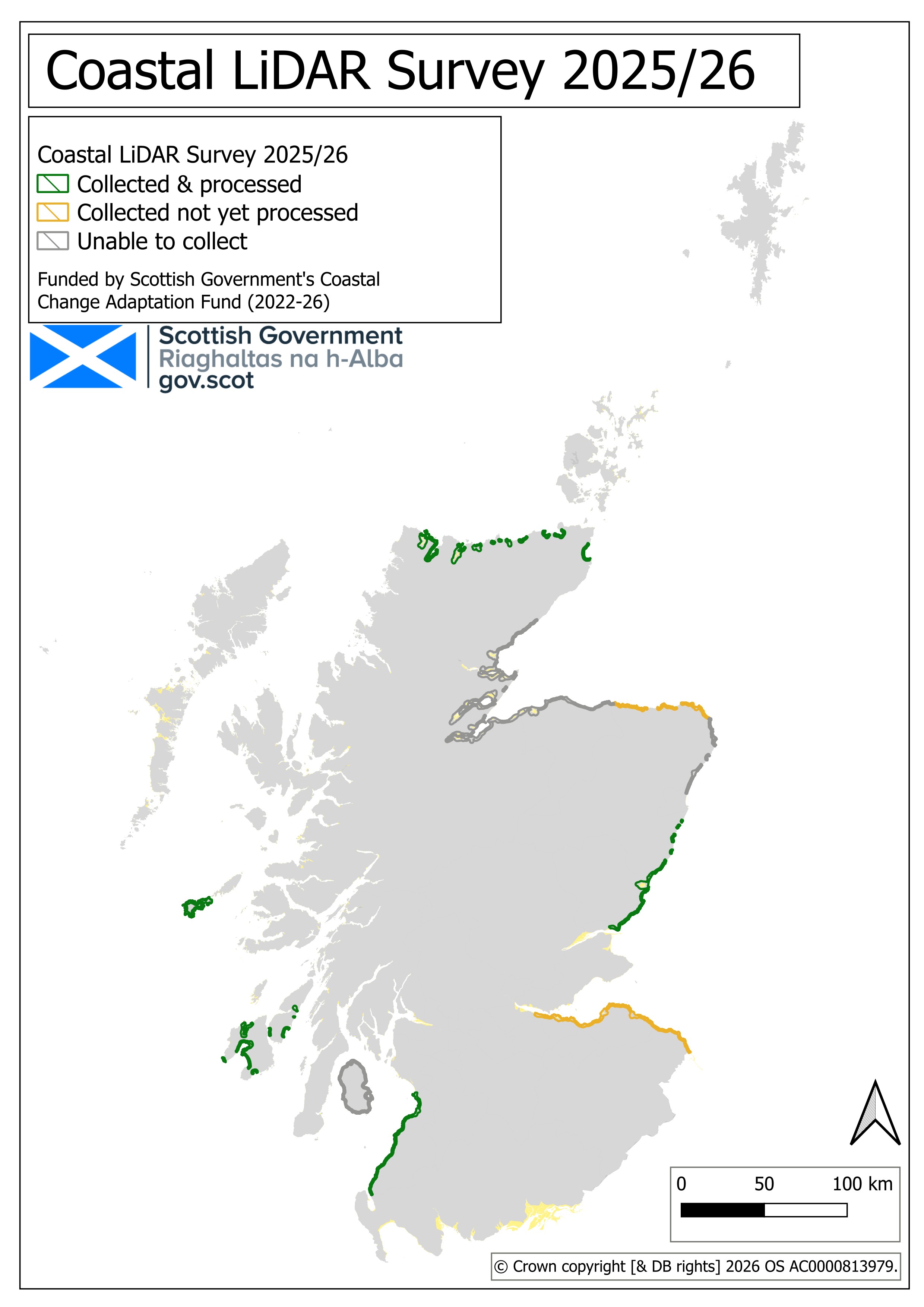
In 2025/26 the Scottish Government allocated £1m funding from the Coastal Change Adaptation Fund for Coastal LiDAR surveys. £100k has been provided to Shetland Islands Council to support their surveys and the remaining £900k will fund a centrally procured set of surveys. These coastal surveys are expected to complement the Scottish Land LiDAR Surveys which are also being undertaken.
What is LiDAR? Airborne and drone-based LiDAR surveys produce highly detailed height maps which inform risk assessments and allow adaptation actions to be planned and implemented.
Coastal LiDAR Survey
The Scottish Government commissioned a series of coastal LiDAR surveys in 2025/26. The procurement exercise was initiated with a Prior Information Notice: Scottish Coastal LiDAR Survey (2025/26).
The 2025/26 procurement documentation can be found here.
Whilst the survey hoped to capture over 1,400 km2 of coastline, given the poor weather 54% was captured. The surveys includes a 1 km coastal strip (inland of Mean High Water Springs) and extends down to Mean Low Water Springs.
The data will be published on the Scottish Government's Remote Sensing Portal, in September 2026. However, time-critical requests can be made to DynamicCoast@nature.scot , though no guarantees are offered.
Summary maps (PDF), GIS shapefiles of the anticipated survey areas are available for download alongside the interactive map.
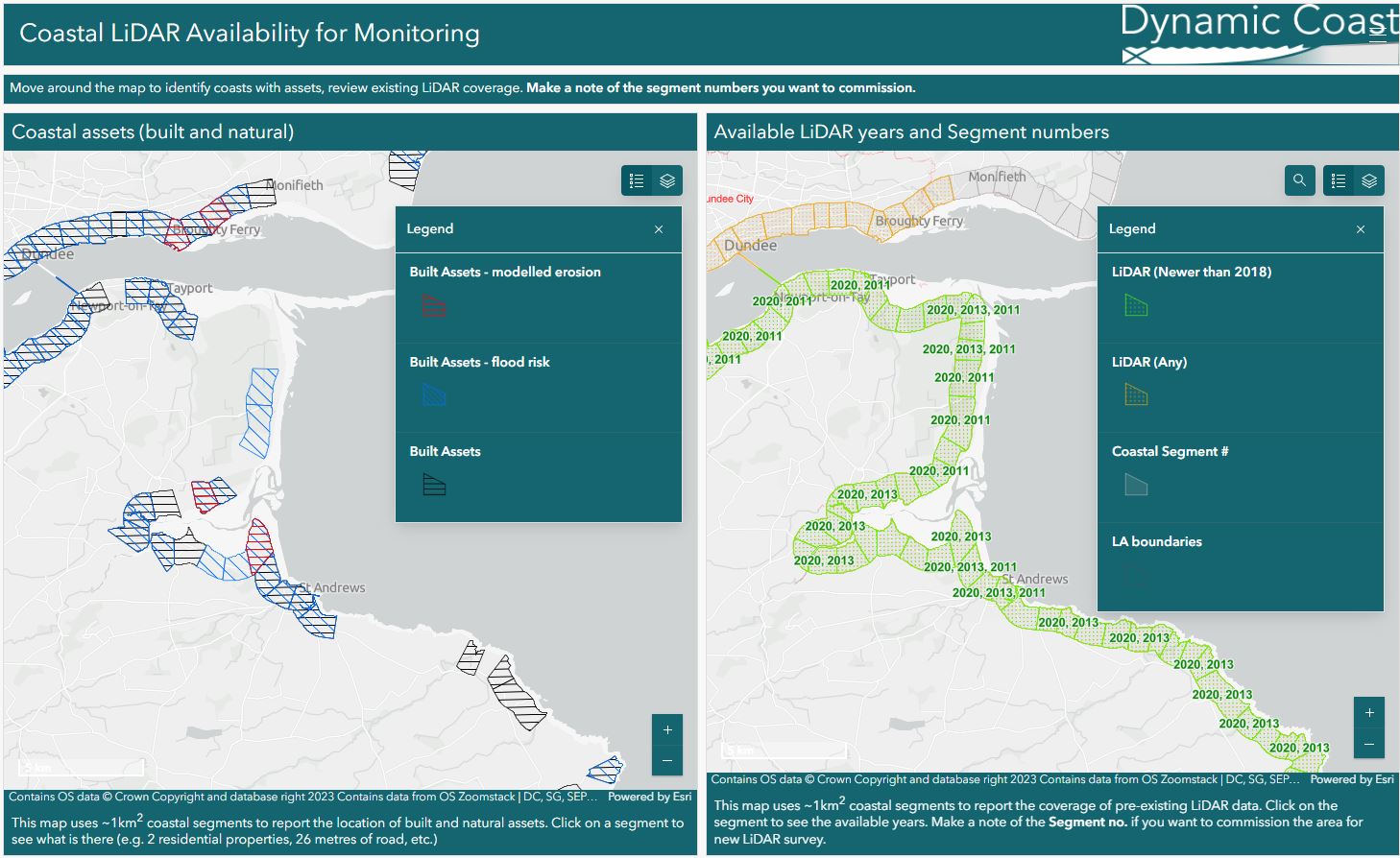
Existing LiDAR
Explore already collected LiDAR data. This maps shows LiDAR coverage and asset data across Scotland's coast.