National-scale mapping is available on the webmaps below. But please note that coastal erosion events reflect chaotic processes and operate at a small spatial scale, so these national-scale maps cannot be used to inform detailed property-level assessments.
They are intended as a broad planning tool, which make necessary assumptions about our future climate and management actions, which might differ in the future.
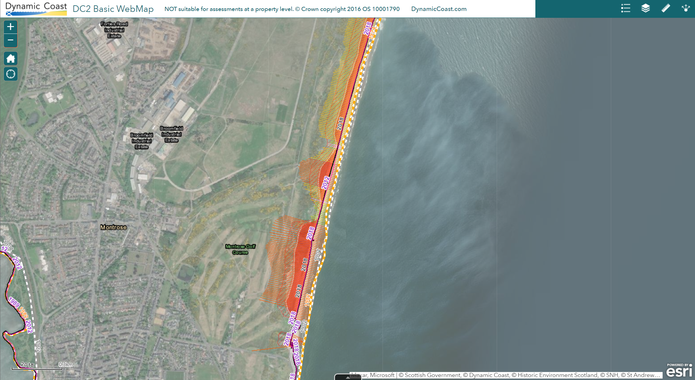
Advanced
Additional data is included within the webmap, adding further context to the above the basic map.
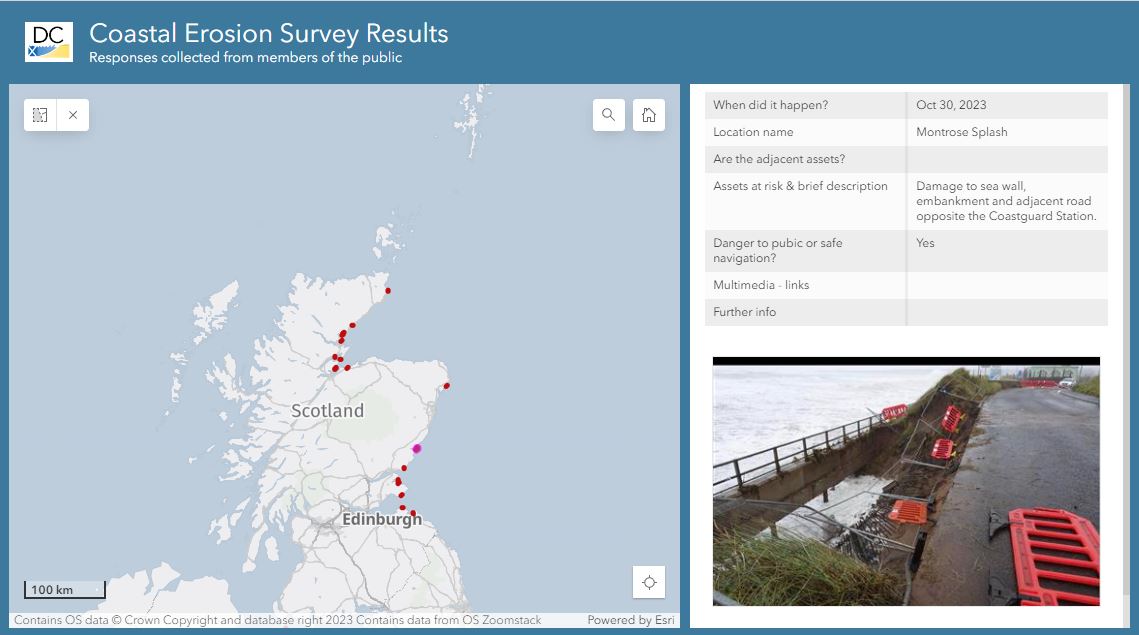
Erosion Reporter
See a map of recent coastal erosion & report new impacts.
These reports help inform the Scottish Government and local authorities' climate adaptation work.
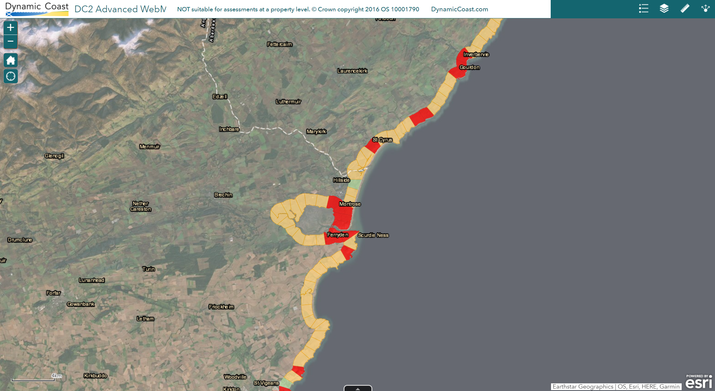
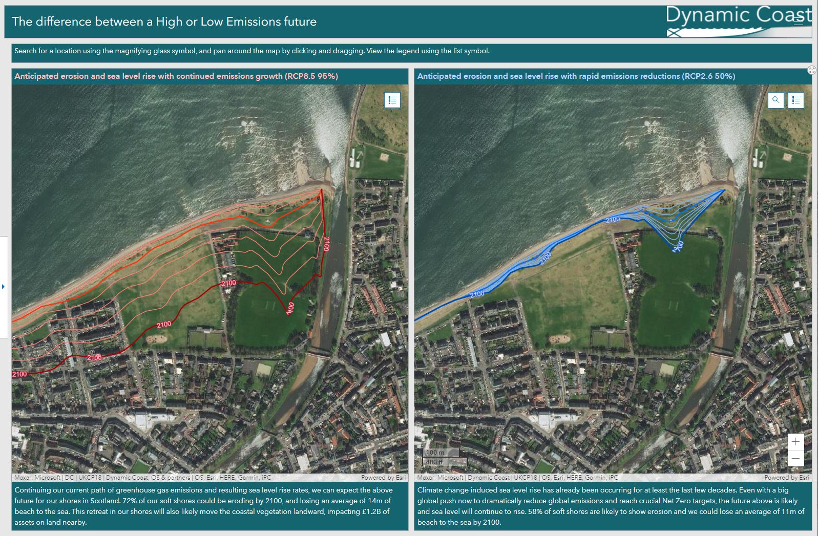
Compare your Future Coasts
Compare coastal erosion for your High or Low Emissions future on our interactive maps
Coast X-Ray
Our satellite data based intertidal mapping tool, to complement the Dynamic Coast analysis.
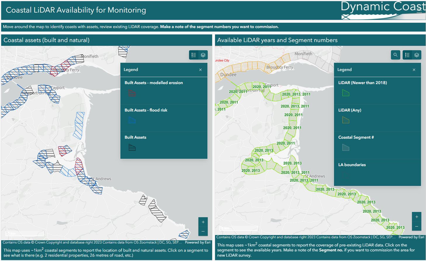
Lidar availability for monitoring
Interesting in coastal monitoring? See LiDAR coverage and asset data across Scotland's coast.
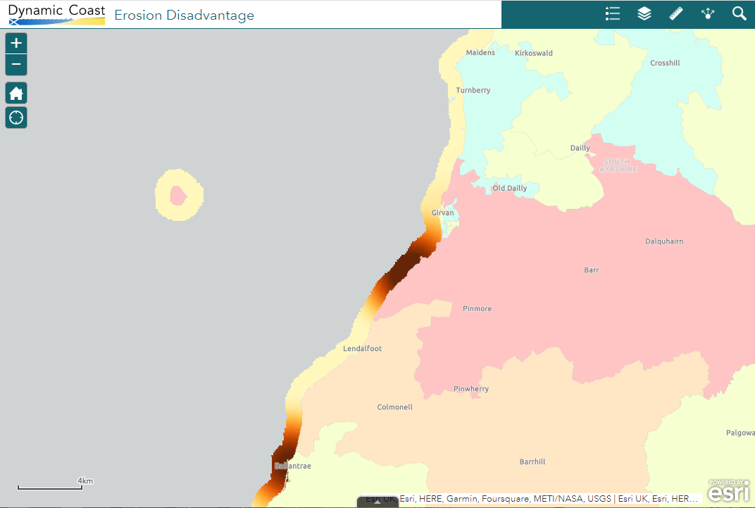
Coastal Erosion Disadvantage
View our coastal erosion disadvantage map, reflecting social vulnerability and erosion risks.